Arizona was the last stop on my multi-state rove across the country. I’d started back in the middle of February, climbing aboard an Amtrak train in Providence, Rhode Island, headed for a week or so of hiking the Cumberland plateau in Georgia, Alabama, and Tennessee. From there I had hopped back on the Amtrak Crescent line for the ride down to New Orleans, where I stayed longer than I had planned.
At some point I had to move on, and rather than endure the 36-hour ride on the train from New Orleans to my next stop in Tucson I opted to buy an airline ticket instead. The weather was not at all cooperating, and I had an unplanned stay in Houston, but eventually arrived in the desert and checked in to my Vrbo, a beautiful little casita in the northeast part of town, just five minutes away from the fun down on 4th Street near the university.
Tucson is surrounded by mountains, and I hiked in several ranges during my stay. Each has its own character. The Tucson Mountains are relatively low and heavily covered with saguaro cactus; the western district of Saguaro National Park is here. Geologically, these mountains expose the remains of a large volcanic caldera system formed in the Late Cretaceous, about 72 million years ago. Rocks in this range include abundant tuff — volcanic ash that has been welded or lithified into rock — along with volcanic breccia and rhyolitic material. Small-scale mining for copper and other metals took place here, but the district never became one of Arizona’s major producers.
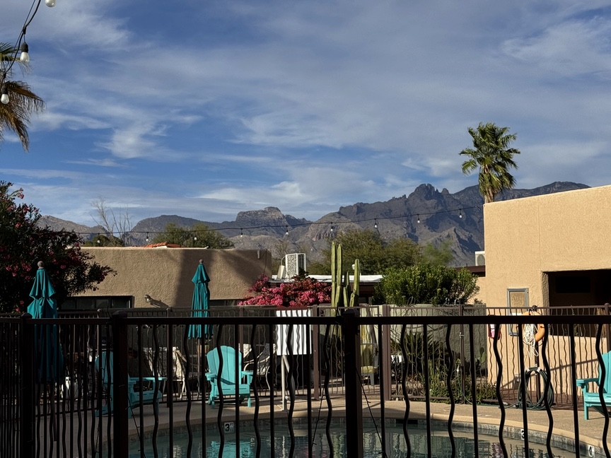
North and east of Tucson, the Santa Catalina Mountains rise abruptly from the desert floor and tell a different story. Around 30 to 20 million years ago, this region was being pulled apart as the crust of southern Arizona extended. As the upper plate moved away along the Catalina–San Pedro detachment fault, deeper rocks in the footwall were exhumed and arched upward, exposing the crystalline core of the range. The result is the Catalina metamorphic core complex, a mountain mass built not by volcanism but by tectonic extension, faulting, uplift, and erosion. Tucson itself sits at about 2,400–2,500 feet above sea level, so the range rises dramatically straight from the basin.
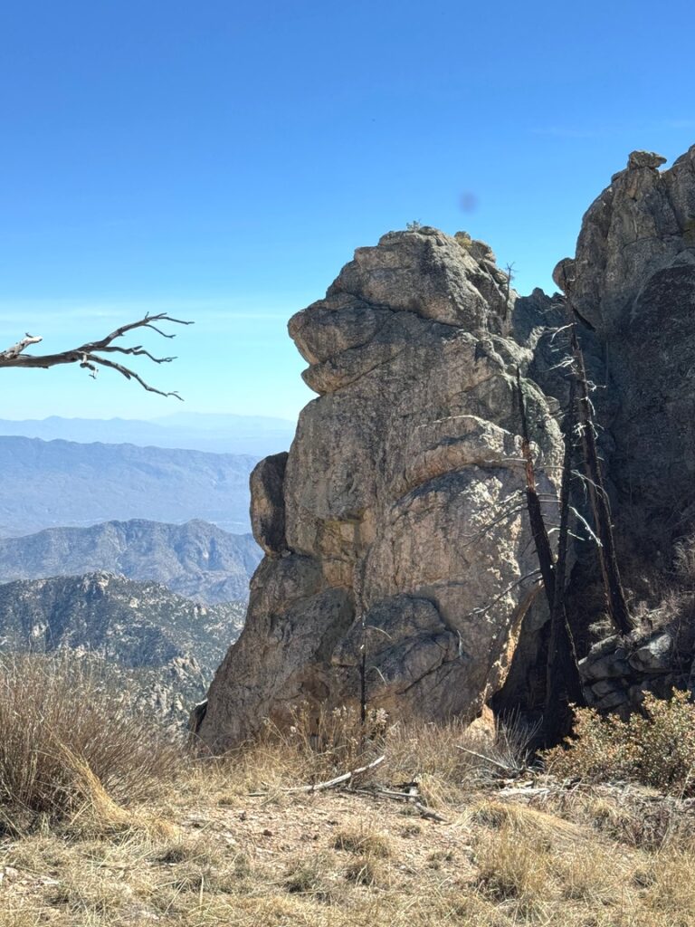
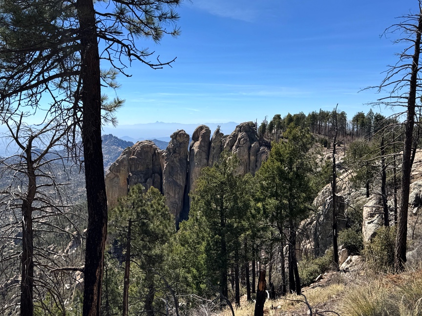
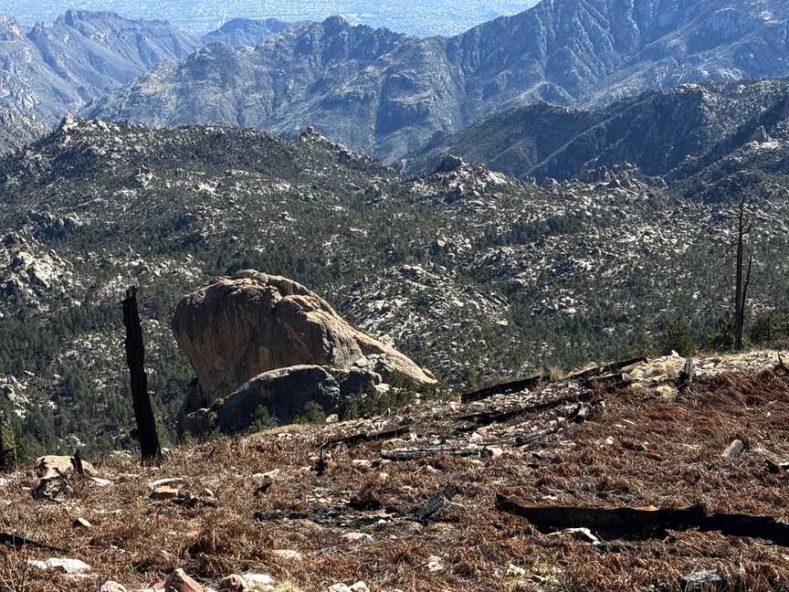
Since then, erosion and later faulting have carved the range down into a rugged spine of resistant crystalline rock and broad aprons of granitic debris. You can see that structure clearly in the photo below. The debris spreads outward in alluvial fans, transported downslope by gravity and water. Much of the granite here weathers as moisture chemically alters feldspar into clay minerals, loosening the rock into a coarse granular material called grus (rhymes with goose). In many places, especially on decomposed granitic slopes, grus is all that you are walking on.
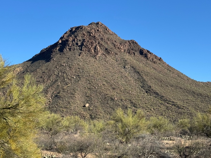
Alluvial fans of mostly grus blanket the flanks of the mountains.
The mission for the day was to do a combined POTA and SOTA activation near the summit of Mt. Lemmon, W7A/AW-001, at around 9,200 feet, and then pack up the gear and go hiking. I wanted this to count for the PN&R Pack Mule award and so I parked about three quarters of a mile from the summit, hiked up, did the activation, and then hiked down to drop the radios and set up for a day-long hike.
I should probably go and read the rules for how SOTA assigns points to mountains. Mt. Lemmon is a 10-pointer, the most points you can get without bonuses for the season. There’s a road that literally allows you to drive right up to the summit, and so I literally just drove my car up the side of the mountain, parked an appropriate distance away, and only had to carry the station the less-than-a-mile to and from the car. Ten points! On the other hand, when I activated W1/HA-009 Monadnock Mountain in NH, I had to hump the entire station up the entire 2 miles and 2,000 feet vertical up and down, for a measly 4 points.
I’m not complaining, since now I have several 10-pointers in my SOTA log, but it really sems like points should be awarded on effort, not altitude.
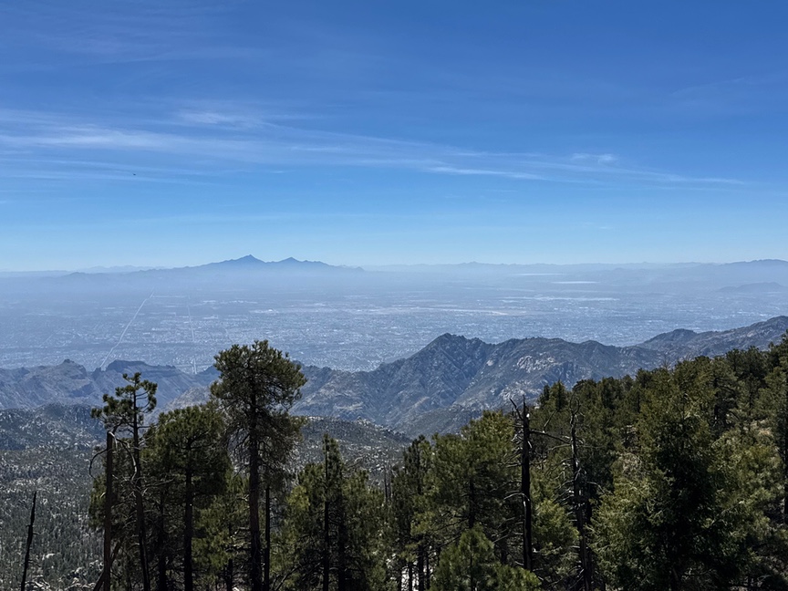
Speaking of driving to the top, it is going to take a while. From Tucson you start at base level on the Catalina Highway toward Summerhaven, and that road is 24 miles long, winding along countless switchbacks as you work your way a mile and a half up the mountain. It is an enchanting drive, and every few hundred yards, on both side of the narrow road, are pull-offs where you can stop and park and just admire the vistas, or let faster cars go past you, which I did quite a bit. It is easily an hour’s drive to get to the top. The photo below is one of the “vista” pull-offs, and this fellow was getting ready to do some deep-space photography.
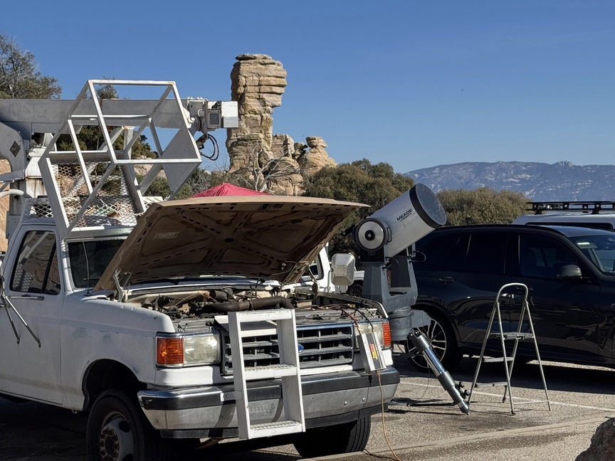
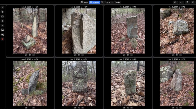
Your elevation is marked each 1,000 feet, and what’s interesting about this part of the Santa Catalinas is that it holds several different ecological zones, starting with desert and saguaro at the bottom and working up through hardwoods and then into pines and a true Alpen feel with high meadows. The geology changes, too, and above about 7,000 feet you’ll start to see more and more of the stacked granite columns known as tors. There are examples in the image above, behind the truck. Here’s a much larger grouping of them, and you can see part of th road winding up the mountain.
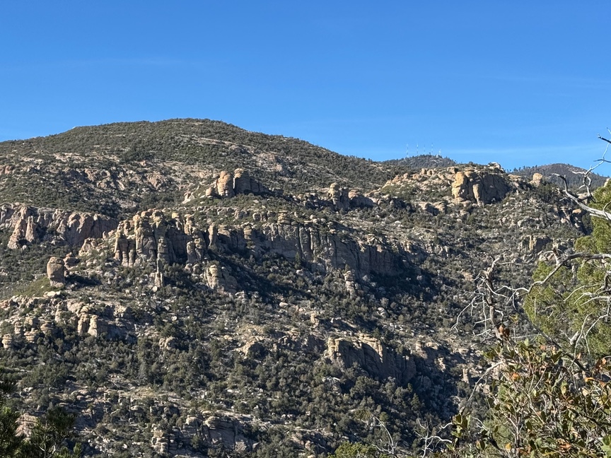
Granite tors dominate the higher altitudes.
To get to the summit, turn off of Catalina Highway at East Ski Run Road and continue past the iron Gate restaurant up the hill. In a few miles you will reach the Mt. Lemmon picnic area and parking lot, however there are additional lots along the way that you can stop at, as I did. There are quite a few picnic tables scattered around, and also a clean, stocked restroom, a feature of the park — there are restrooms all along the road and at each major trailhead. Parking requires a fee, currently $10, and there are kiosks set up here and in other places in the park so that you can pay. One of the advantages of being as old as I am is that I carry a Senior National Park Pass, which is good for what’s left of life and I think was just $35. It has paid for itself many times over!
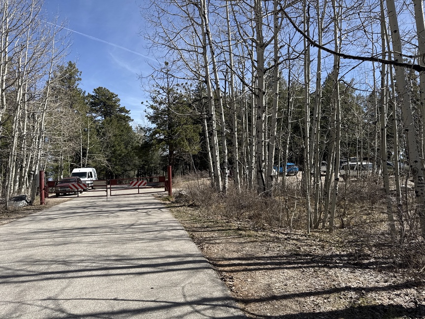
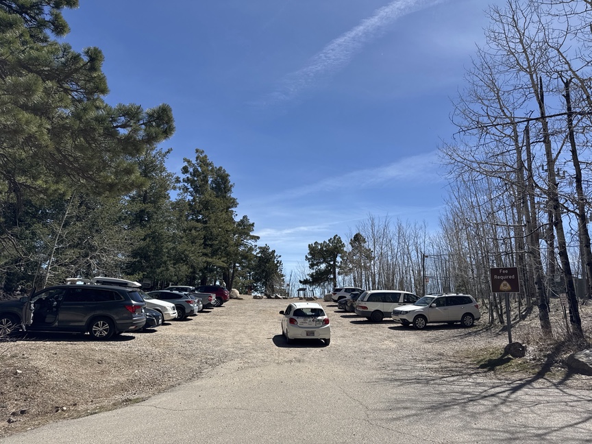
Parking and facilities at the summit of Mt. Lemmon
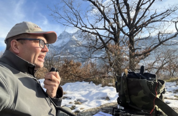
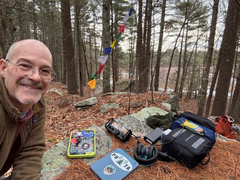
The activation was really fun. I set up on Radio Rock, an outcropping that is near a commercial radio tower and a popular spot for people to hang out and have lunch while admiring the view from 9,200 feet. I’m currently carrying an Elecraft KX2 that feeds a 17′ whip mounted on a Gabil tripod. I use four 32′ radials. The combination of having the antenna up 9,000 feet and being on a 10-point hill meant that I only needed to call CQ once or twice and then just work the pileup, which was steady but not overwhelming.
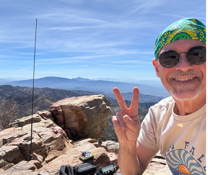
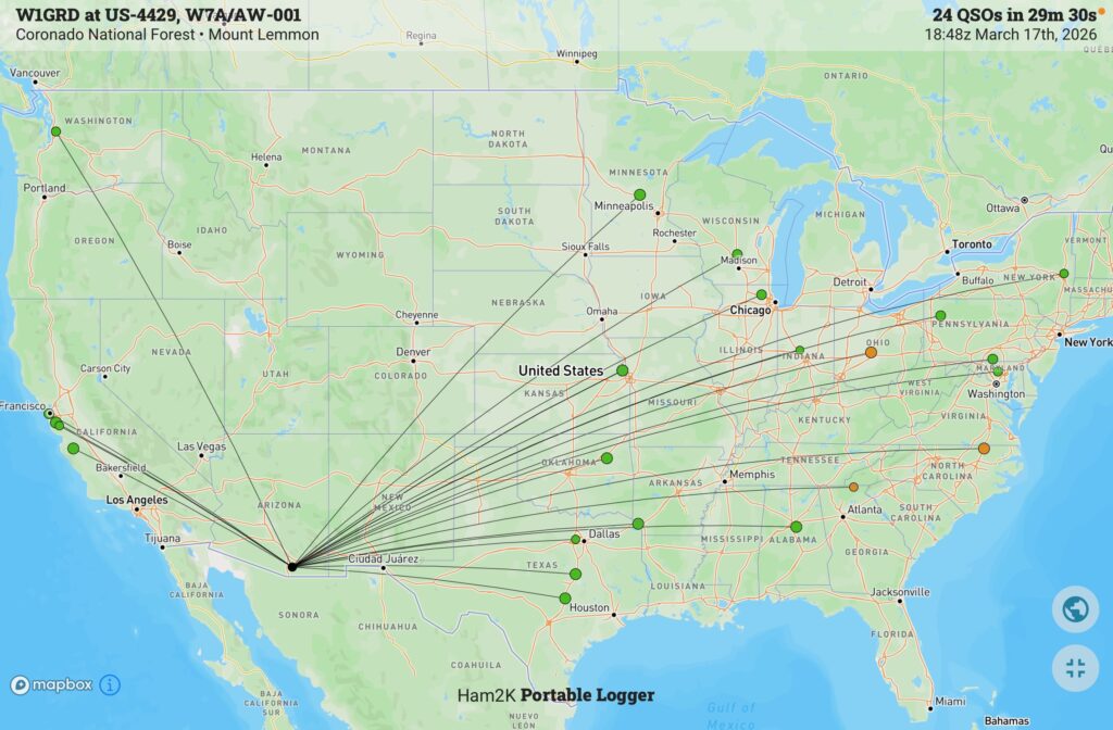
Being up high really makes a difference!
When I set up, I was the only person around, but as I worked through the activation folks came and went, and a few stopped to ask what I was up to. I love talking to people about the hiking and the radios, and I handed out three or four of my POTA stickers with the PN&R URL printed on them. I especially like answering questions from kids, because you just never know what might spark their curiosity.
Once I had the Pack Mule in the bag, so to speak, I hiked back down to the car, dropped off the equipment, and set up for a day’s hike along the Mt. Lemmon Trail, which runs for a few miles along the ridge line before dropping lower down the side of the hill.
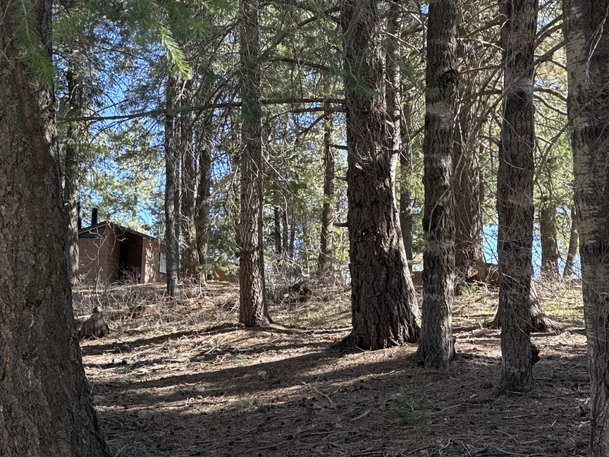
One thing that is really unique about hiking at this altitude is that there are plenty of trees to offer shade. It was in the 90s F down in Tucson proper, but up here it was still in the 80s and the cloudless sky means that the sun is always beating down on you, and the shade is really welcome. The trees tend to be in small groves on this trail, and a major fire just a few years ago removed quite a bit of the canopy.
For those who aren’t used to hiking in the high desert, a few words of caution: Manage your sun exposure with sunscreen, hats, bandanas, or even long-sleeved sun shirts. The thin air and constant exposure mean that you’ll burn quickly. And always carry more water than you think you need. In warm weather on level ground, like where I hike most of the time in New England, I’ll drink about a liter of water during a four-hour hike. During my desert hikes and hiking at altitude I carried 3 liters and drank nearly all of it each time. Dehydration happens quickly, too, and you won’t notice it until you have a problem. Drink your water.
The hike along the ridge is all about the vistas. It seems like every time you turn a corner there’s some new spectacular view to make you stop and stare. I did the hike as an out-and-back but chose the higher Meadow Trail on the way back, which adds a few hundred feet of elevation. You’ll see an endless variety of quartz up here along the trail, evidence of some of the violent history of the mountain range.
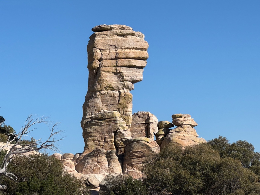
At one point I was slightly off trail looking at an enormous bowl-shaped valley and admiring some of the tors, especially one that I thought look a lot like a turtle poking his head out his shell…
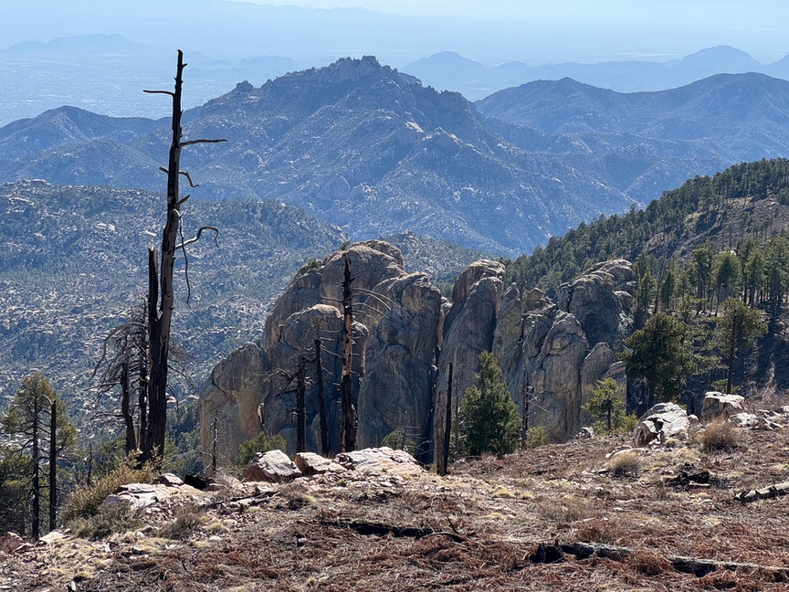
The Turtle and the Elders at Mt. Lemmon.
A couple walked over wearing what I thought was the type of clothing a tourist from Illinois might wear if they’d read they were heading for the desert. We said hello and I pointed out that I was admiring the Turtle and thinking about The Legend.
“Legend? What’s the legend?” one of the tourists asked.
“Ah, the Ho’okam people who lived here for thousands of years believe that the world is carried on the back of a giant Turtle. This entire valley below was all water in the Early Times, and the Turtle would poke his head up every 1,000 yers to take a breath of air, as turtles do. Do you see him?”
“Yes!” I pointed to the columns over to our right.
“The Elders were so excited to see the Turtle take his breath that they all rushed to the shore to see it. But, as you know, Turtles are quite slow, and the Elders, as they waited and watched, slowly turned to stone. Now we see them and remember their story.”
I was completely making this up, but they seemed impressed and thanked me for telling them the story. I sincerely hope that they told someone else that they met on the trail, because that’s how legends start!
As we parted, I wished them a safe hike and pointed out that if they hadn’t run into Elder Bear, he was right around the corner, down the trail, and would be delighted to see them…