It took me a while at Cloudland to figure out why I was so unsettled on the trail. Things looked familiar but there was just something…off. What the heck was it?
I was on the first hike of what would be several on my 30-day rail rove across the southern and southwest United States. In January, around the middle of the month, Amtrak puts their Rail Pass on sale — it is normally $500, but for a short time at the start of the year you can grab one for $250. That gives you 30 days and 10 segments on any Amtrak train. A segment is spent when you board a train, for example to get to Atlanta from my starting point in Providence RI, I had to spend a segment to get to New York City, switch trains, and then spend another to get to Atlanta.
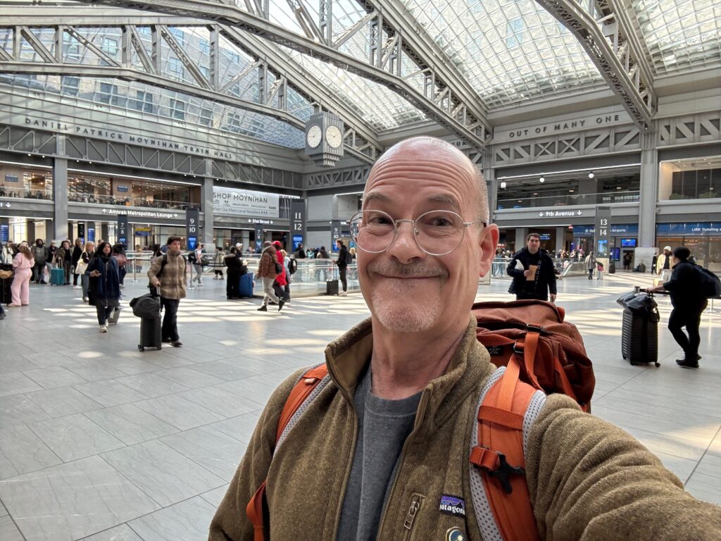
W1GRD at the Moynihan Train Hall in NYC, still looking pretty chipper!
It was a tough winter in New England, and the day before I departed we’d endured a massive blizzard, the worst in recorded history. I measured 30″ level on our deck and a little over 3 feet in drifts. Fortunately it was a relatively light snow and clearing was complete and roads passable in time to get to the train station in Providence. The idea was to head for somewhere warm and also get some POTA activations in the log in between hikes.

This is why I headed somewhere warmer…
And so, a day and a half later, I stepped off the train in Atlanta, rented a car, and headed for my Vrbo in Menlo, Georgia, in the northwest corner of the state for a week of hiking.
I had chosen Menlo for access to Cloudland. The West Rim Loop Trail there had recently been voted one of the Top 5 Hikes in the country by Bacpacker Magazine, and I wanted to see it for myself. The trail is a lollipop, with a large loop of around 4 miles and a ‘stick’ of around a mile. I parked in a small lot up on the loop — to get there, take the first left past the entrance kiosk, about a quarter of a mile, and head up the road for a few miles. You’ll see a turnout on the left going up a small slope, that’s the parking area and trailhead.
As of March 2026 the day use entrance fee is $10. The visitor center has moved temporarily to the bottom of the ‘stick’ while a new one is being built nearer the entrance. You’ll find basic supplies, souvenirs, and food items — Cloudland has a large campground and this is a combination visitor center and camp store.
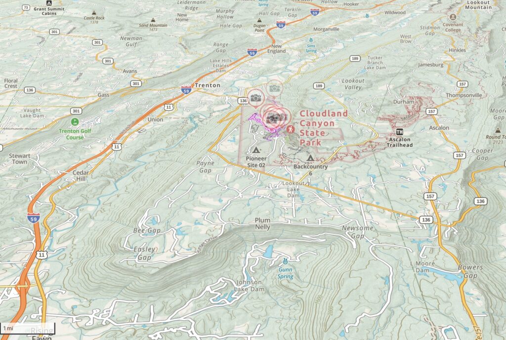
The topo map above shows the shape of this part of the country. The upland plateau sits at around 1,600 feet, and the streams have cut down into it over geologic time. Chattanooga is in the northeast corner of this map. You can see how the flat area has been channeled by the streams flowing across it.
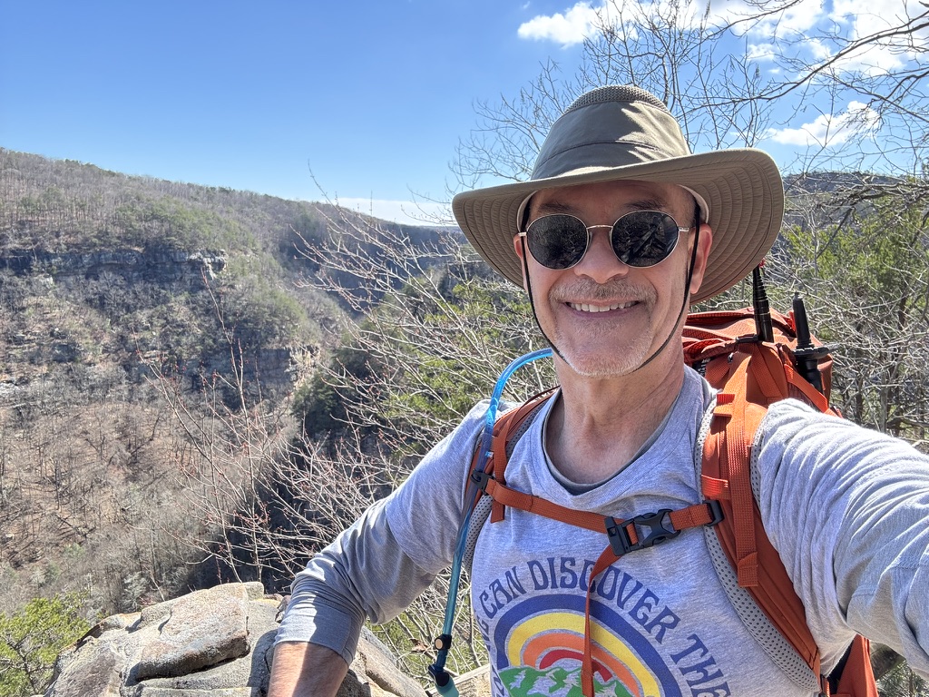
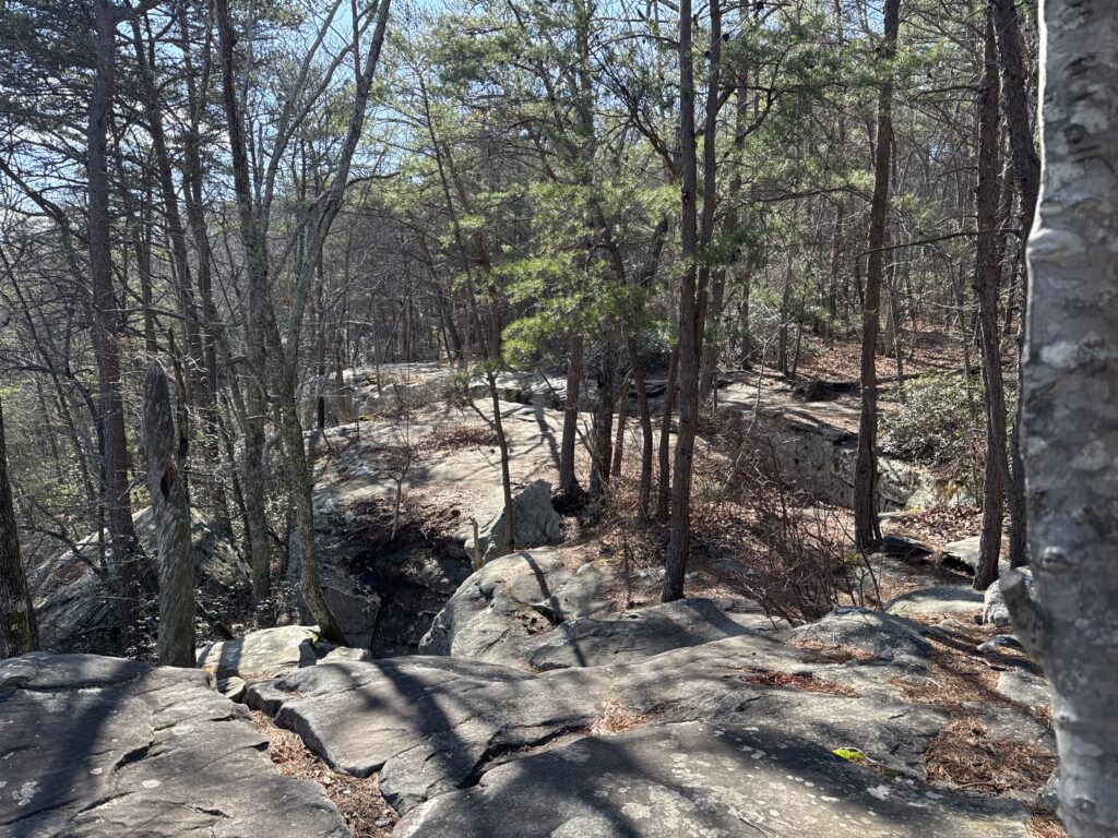
At the top of the plateau looking down into history.
That’s the view that unsettled me a bit. What was different is that I typically hike in New England, and when I get a look like this it’s because I’ve climbed a few thousand feet up some hill. This is not at all what is happening here.
In New England the topology is formed by the collision of continents. It has happened more than once. When a continent the size of Africa ran into the east coast about 250 million years ago, it created massive mountain ranges — these would have been taller than the Himalayas — that over hundreds of millions of years eroded to the state in which we see them now. The Appalachian and Piedmont ranges are good examples. In these areas the main rock-forming events were violent, with lots of magma, lava flows, and later on the formation of the granites and other igneous rocks that we see traveling around the New England states.
At Cloudland it happened differently. At the boundary of what would become North America, when Africa hit us there was a large crumple zone. In Georgia the result was the formation of the Piedmont range, and then a series of valleys and ridges to the west of that. Most of the energy was dissipated near the strike, and so the further inland you go, the less pronounced the ridges will be. Behind those ridges, an enormous section of ancient sea floor was lifted up about a half a mile. It didn’t crumple, it just moved upward, doming and forming cracks and faults the same way a sheet cake might if you lifted it up from the bottom. The sea had been relatively shallow and fed by rivers and streams, and over hundreds of millions of years uniform layers of sandstone were laid down, thousands of feet thick. Near the sea’s coastal areas, rivers formed deltas and estuaries that built shale, and every few hundred thousand years a flood event would wash some of this down across the sand at the seabed.
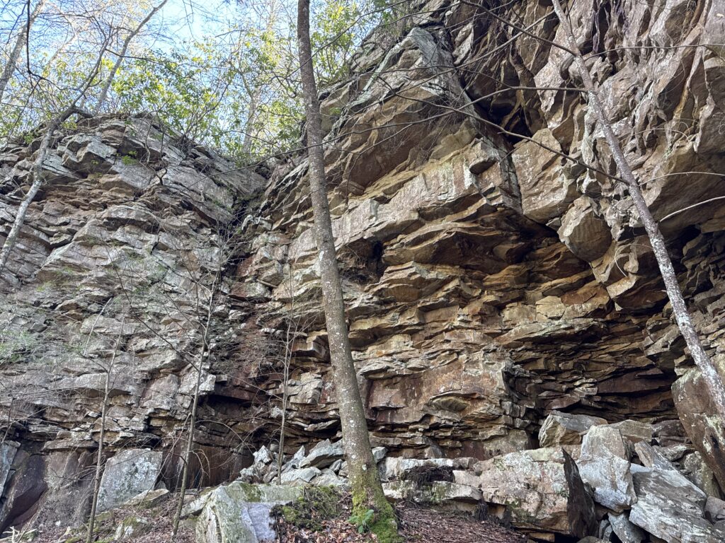
Erosion along the rim of Cloudland Canyone
The image above tells the story. The sandstones that blanket the plateau were eroded in this area by the Sitton Gulch, Bear, and Daniel streams. Along the canyon rim, the resistant sandstone caprock forms the cliff edge, but the weaker shale layers beneath it weather and fail more readily, helping undercut the cliff and send sandstone slabs downslope into the gorge. The sandstone tends to form vertical cracks internally, and the result is that big blocks and ledges of sandstone are undercut as the shale erodes and fall as one piece.
At the lip of the canyon you’ll see a series of scalloped edges at the places where water comes over the top, and you can sequence these in time by observing their shapes. New erosion tends to be relatively small and forms sharp angles as the cut travels nearly vertically and shows large fallen blocks near the base. Very old erosion has a broad, circular shape and you’ll see quite a lot of smaller debris at the bottom, larger blocks that have eroded away.
The vertical cracks present in the sandstone conduct water down below the surface in many cases, and that water will soon run into a layer of shale, where it will quickly erode out material, creating new paths for water to percolate through. As you look at the walls of the canyon at Cloudland you can trace this process and see exactly what is continuing to shape the canyon and plateau today.
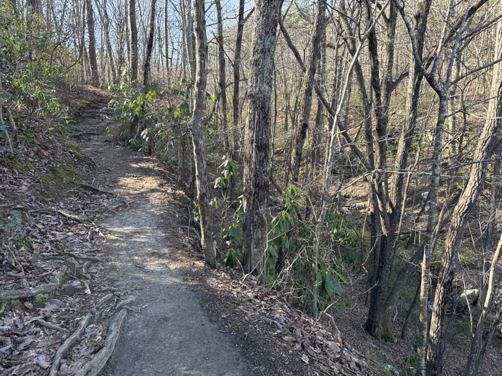
West Rim Loop Trail
The West Rim Loop trail can be accessed from just about everywhere in the park. One option is to drive straight past the entrance gate until you reach the main camping area. You’ll find the park store and interpretive center here, plenty of picnic tables, toilet facilities, snacks, and the like. The trailhead is well-marked and easily accessible from here, and there are several overlooks and side trails to take, too. The Sitton’s Gulch trailhead is here, providing access to the canyon below and some spectacular waterfalls. I’ll talk about that trail in its own section.
You also can pick up the West Rim Loop on the opposite side of the canyon, which is what I did for this hike. To get there, take the first left after the entrance gate and continue for about a mile until you see a small sign on the left for trail access and parking. Even though the trail is a loop of around six miles, two of those miles are consumed in a down-and-back lollipop stick at the end of the loop that brings you to the main camping area.
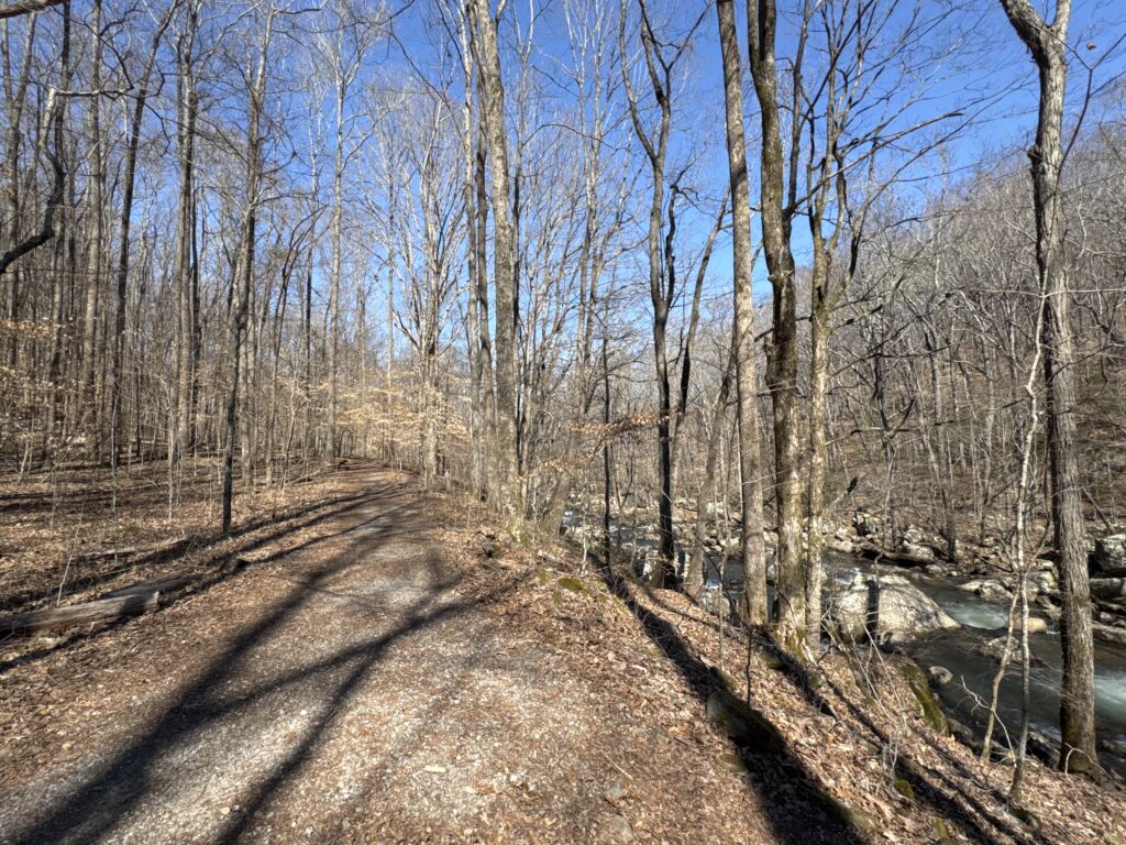
The hiking here is easy and it almost seems like you are cheating as you walk along the fairly level rim and get a succession of incredible views down into the canyon about 1,500 feet below. Here’s a typical part of the trail here. Every few hundred feet you’ll pop out into yet another panorama.
The canyon side of the West Rim Loop can be narrow — for activating, hike the other side of the loop.
I felt that the canyon side didn’t have that many spots to pull off and do an activation, although that’s exactly what I did. Just before the loop connects to the ‘lollipop stick’ portion of the trail, there’s a fairly broad area that slopes up gently away from the canyon, and that was the spot I picked.
Just upslope from here is a great spot for an activation.
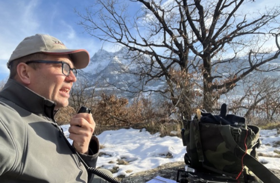
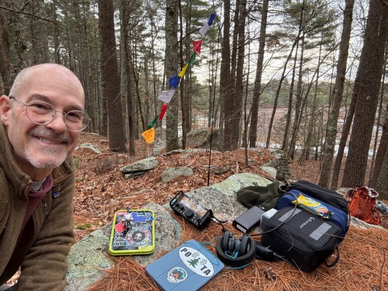
I was working on a Pack Mule activation and so I stuck around to get 22 QSOs into the log, using the KX2 and a 17′ whip mounted on a Gabil tripod. The weather was just outstanding, and this was the first activation of my long rove. I hadn’t brought that much with me on this trip, no tools, not really any backups, not even a wire antenna, and I was happy that everything worked properly, and that I didn’t seem to hav forgotten anything. In the back of my head I figured that if the tripod or vertical failed, I could use the four 32′ radial wires to rig up a dipole or sloper of some sort. I’d even left my beloved Begali Traveler, a veteran of many hikes, at home due to the weight.
In the end my obsession with weight saved me, because the third leg of the trip was supposed to be on Amtrak from New Orleans to Tucson, and the more I thought about 36 hours on the train the more I leaned into buying a plane ticket west, which is exactly what happened.
Sitton’s Gulch Trail
When I’m in an area mainly for hiking, my habit is to do an activation on a very early hike. I’d say that it is to get the activation ‘done with’ but that sounds a little harsh, mainly it’s that if I’m in a new area, which is quite a bit, I like to really focus on the hike and what I’m seeing without the distraction of carrying the station around. At Cloudland I knew I was going to do three hikes, and so I picked the easy one along the rim for the activation and did it first. It also gave me a really good idea of structure the park and what was where.
The next hike was not the easy one! Sitton’s Gulch Trail sits at the bottom of the canyon, and it is an out-and-back of around five miles if you just hike it straight. There are several small trails to explore that branch off, but for the most part you are walking right along the creek that has spent a considerable amount of time eating its way down from the plateau.
The easiest way to approach the trail is to start near the camp store and nature center in the main parking area. The major trails converge here, and so you can hop on to the West Rim Loop from here, just spend time viewing Cherokee and Hemlock Falls, or continue on to pick up Sitton’s Gulch. Since you are there already it would be silly to bypass the two large waterfalls! Here’s a view of Cherokee Falls from the top:
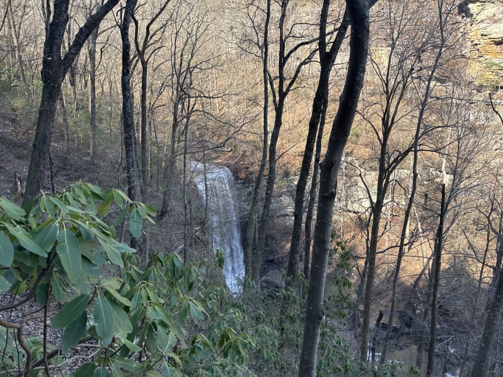
Cherokee Falls from the rim.
To get down the face of the canyon, just take the stairs, all 606 of them!
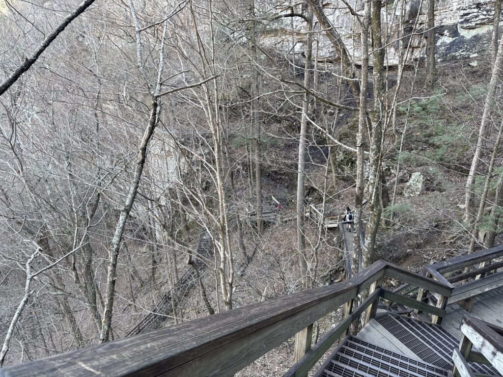
Happy to have railing…
Going down isn’t terrible, but don’t forget that you’ll need to climb those stairs after the long walk down the trail and back!
This part of the trail is all about the waterfalls, but it also gives you a really good look at just how active water is here in shaping the park. Apart from the cascades you’ll also see smaller waterfalls, many spouting right out of the side of the canyon. Or you might see seeps, where a portion of the canyon wall is wet from water being transported down and along a silver of shale. And you’ll be looking up at the scalloped edges of the canyon where water is eroding the lip, and walking through the resulting rubble field. It’s an active erosion zone and an excellent field lab to understand several different erosional processes.
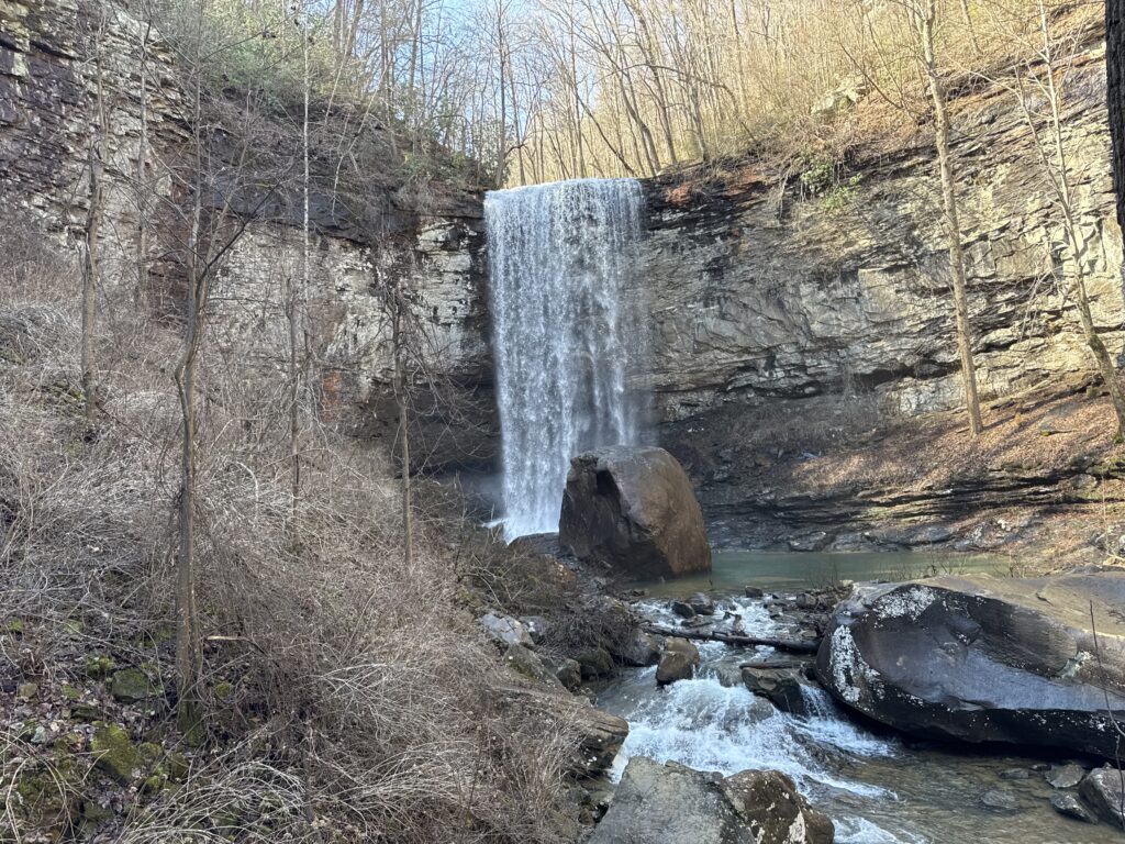
Cherokee Falls at the top of Sitton’s Gulch Trail.
Once you are down the stairs and past the waterfalls, the trail is level as it works its way down the stream. At the other end is a parking area with restroom facilities, and quite a few hikers park on that end and hike in to see the waterfalls — it avoids the stair-climbing. On a hot day you can splash stream water on your face for a quick pick-me-up, and I saw many families just chilling on the banks of the stream, playing along the rocks or having picnics. The parking area is in Trenton, and it’s about two miles from there to the falls.
Sitton’s Gulch Trail outbound along the creek.
I don’t think that this part of the park would be all that great for an activation. For one thing, you’ve got 1,000-foot canyon walls on either side of you, relatively close. It’s also fairly noisy along the creek, with a large number of shallow rapids dotting the length of the trail.
Thoughts on the Menlo area
For this leg of my trip I chose a Vrbo in Menlo, Georgia, which is tucked up in the corner where Alabama, Georgia, and Tennessee meet. The place was adorable, a tiny home situated just off the brow of the canyon and part of a little community of about ten similar houses. I was there about ten days, and it wasn’t long after I moved in that the animals showed up — I must give off some St. Francis kind of vibe. I named everyone after Grateful Dead references, so there was Stella Blue the cat, Jer Bear the dog, and, not shown below, Tennessee Jed the tabby cat.
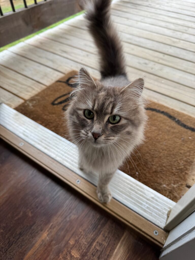
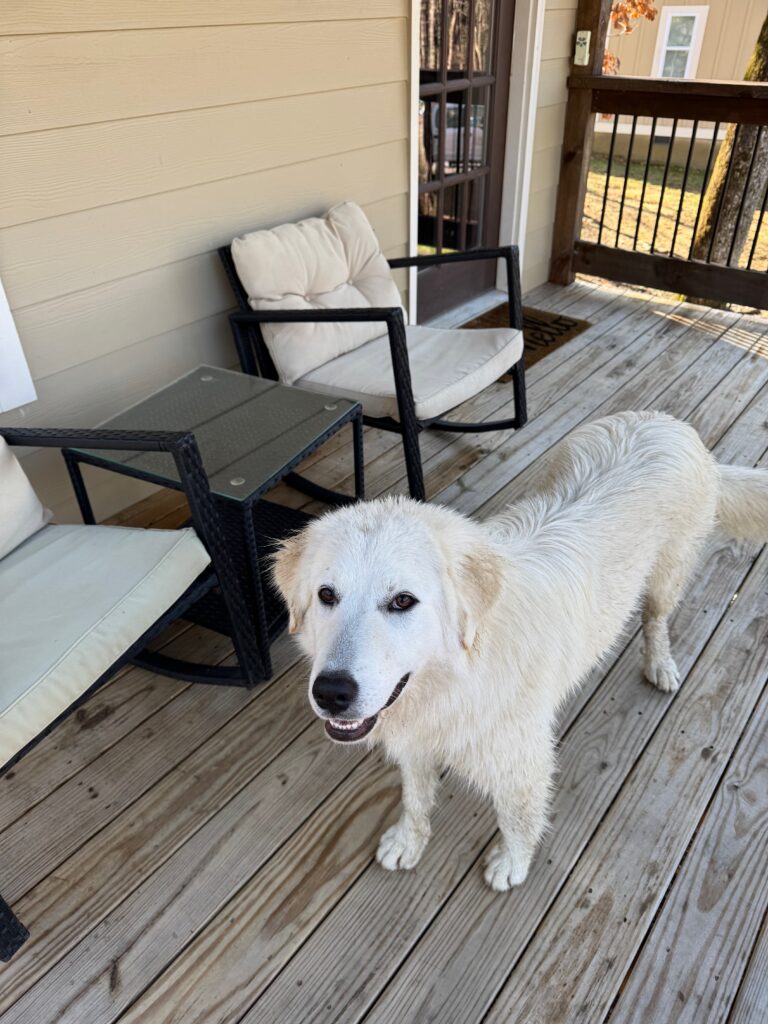
Stella and Jer Bear and (not shown) Tennessee Jed the Cat were great companions in Georgia!
One caveat: There’s pretty much nothing to do here except hike. The nearest gas station is a good 25 minutes away, and your options are pretty limited in terms of groceries and restaurants. Trenton is the nearest town and honestly doesn’t have much going on. However, access to hiking is second-to-none. The Vrbo was about 15 minutes from Cloudland’s main gate, and only about an hour to excellent hiking in both Alabama and Tennessee. Chattanooga is less than an hour away and is a really fun town — drop in for a beer at Chattanooga’s only geology oriented dive bar, Hutton & Smith for a salon-like experience. There were five of us in the bar, and I was the only one without a geology degree but I am happy to report that I held my own!
Leaving Menlo was tough, by the end I had settled into a nice routine, the critters were snoozing on my deck, and I was truly loving the geology of the area. My Amtrak departed Friday morning from Atlanta, about two hours away, so instead of racing over at oh-dark-thirty I booked a room in Atlanta and spent half a day exploring the area on a Lime scooter. On the way I stopped at the Tellus Science Museum in Cartersville, amnd it turned out to be a really nice set of collections, especially the The Weinman Mineral Gallery, one of the best mineral collections I’ve sen outside Boston. They also have a large dinosaur exhibit and a lovely transportation wing with antique vehicles.
The train was on time, and I hopped on, stowed my gear, and settled back for the ride to New Orleans and a little down time.