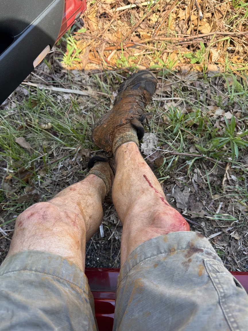
Standing ankle-deep in deep red marsh mud, blood running down my legs, in a stand of reeds so thick that I had a compass in my hand to try to navigate, I started to wonder about my life choices. There had been a few opportunities to turn around and call it a day, but I have this thing about being the first person to activate a POTA reference, and Flynt Mountain was one of seven ATNOs that had popped up on the past week in Massachusetts. One close to home had been taken, but Flynt and nearby Rattlesnake Mountain were still showing 0 activations as I packed up the KX2.
I wasn’t sure about the conditions on site, but my guess was that on a roughly 900-foot hill in this part of the world I’d probably be in mixed pine and hardwood, so I packed both the 17-foot whip and Gabril tripod, and a 40m EFHW and associated paracord. Lately I’ve just been carrying the vertical and have been doing well with it, but with a new POTA reference I wanted to give as many folks a chance to work it as I could, and the wire performs a bit better than the vertical in most situations.
The first clue that this wasn’t going to be easy was simply finding the place. Here’s the official Commonwealth map:
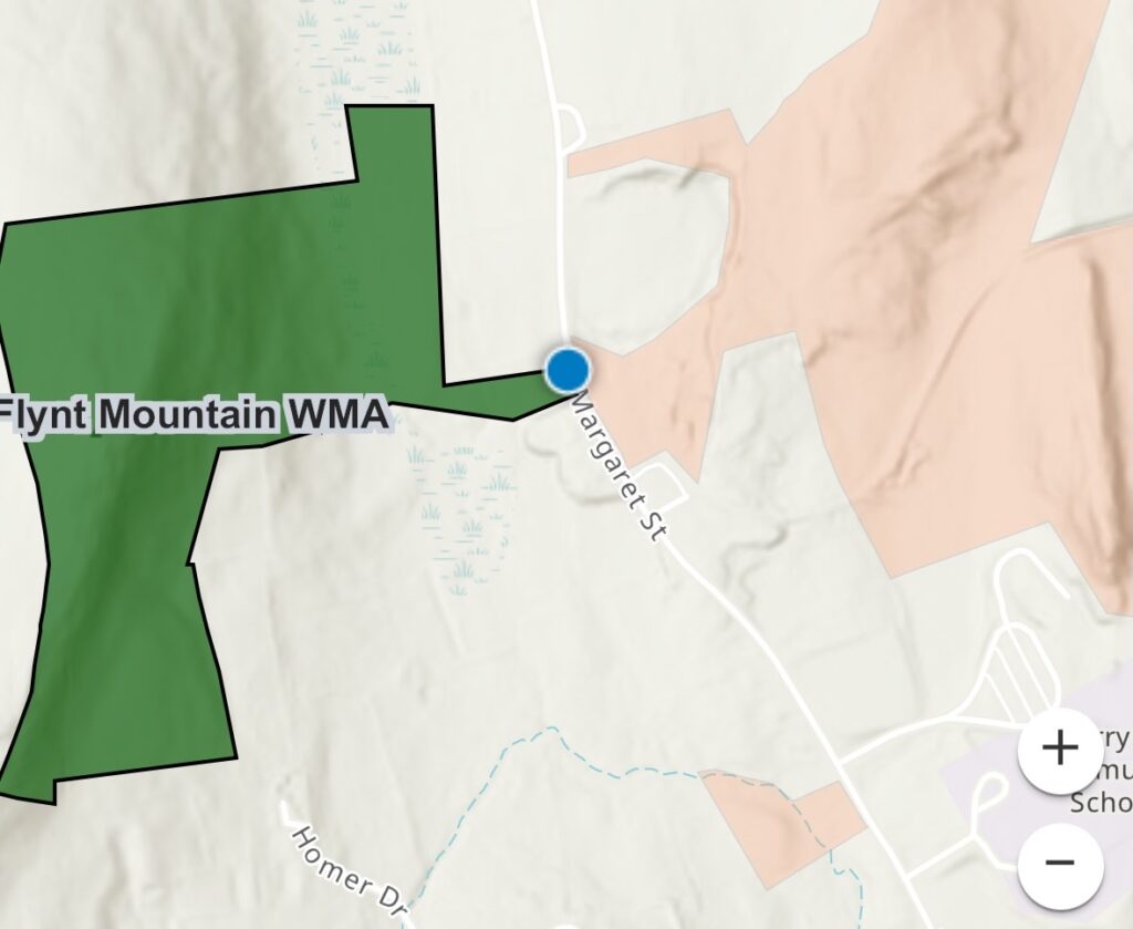
The good news is that there is a conservation area around the old Flynt granite quarry directly across the street from the WMA, and there is a small information kiosk for the quarry that you can park in front of. Note that Google Maps will bring you to someone’s house on the opposite side of the ridge, so aim your GPS toward the Flynt Quarry. Once you are there, look across the street for a small reed-filled marsh flanked by homes. That’s the entry point.
Technically you could activate from the marsh. My thought was to get up on the ridge just under a mile away, which meant crossing the marsh. My advice is to hug the boundary to the right as you walk in, it is a little less wet and the reeds are not as dense. You’ll have to crawl through the understory at one point, but just on the other side is a proper swamp, and that’s quite a bit easier to get through. Be careful going down the steep embankment into the marsh as it is not only steep but covered with broken glass and briars.
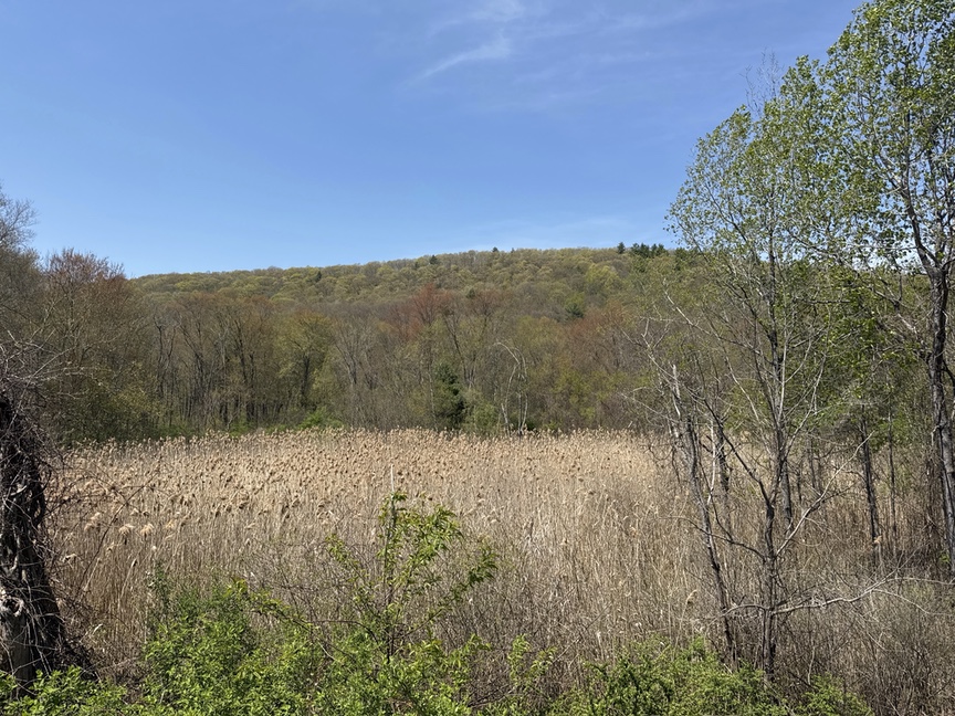
Just past the marsh the terrain opens into a swamp
I visited in the first week of May, and the wildflowers are in bloom, offering a welcome relief to the muck I’d just been through.
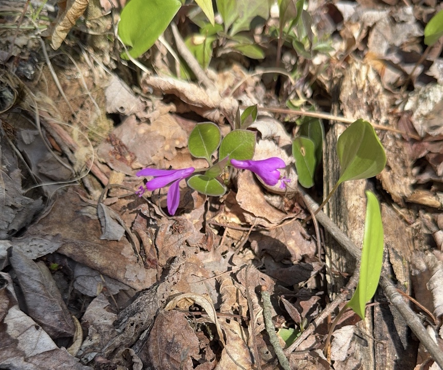
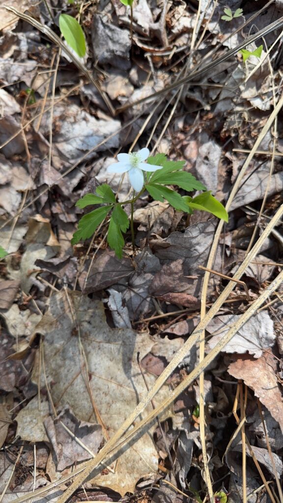
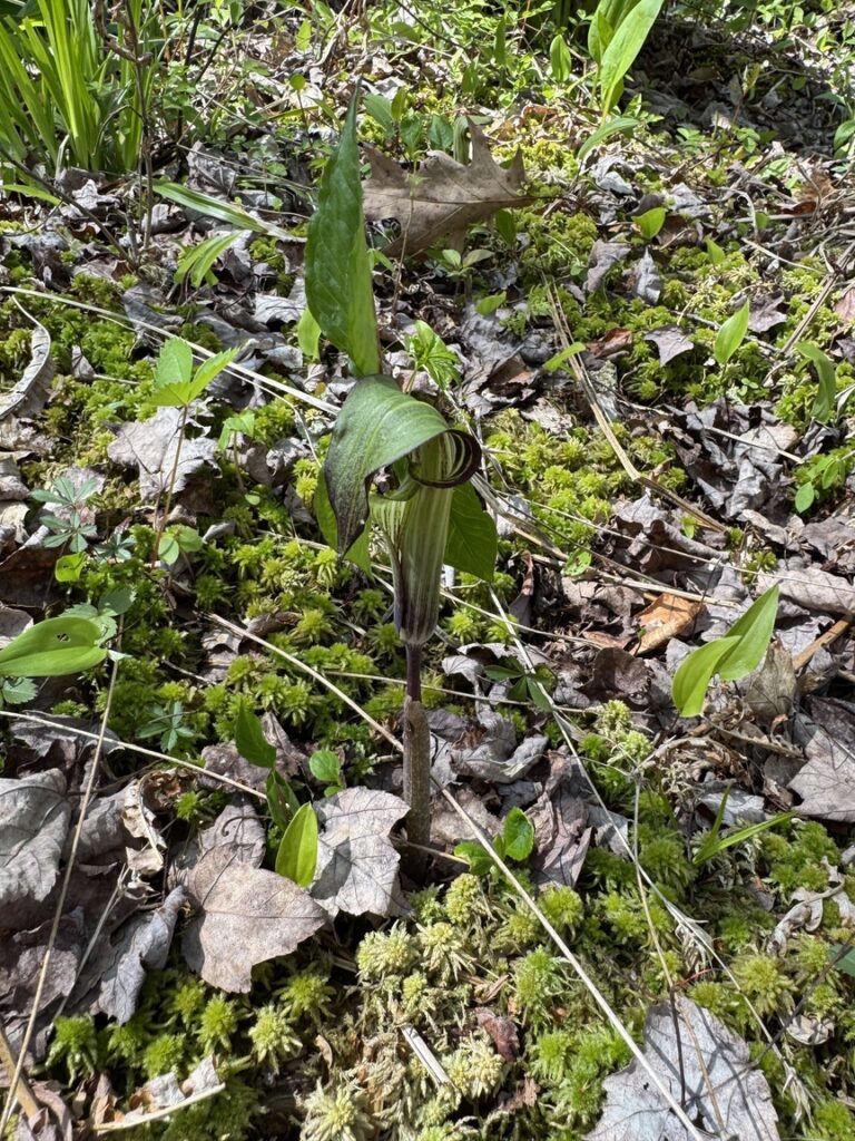
Violets, anemones, and Jack-in-the-Pulpits in bloom at Flynt Mountain.
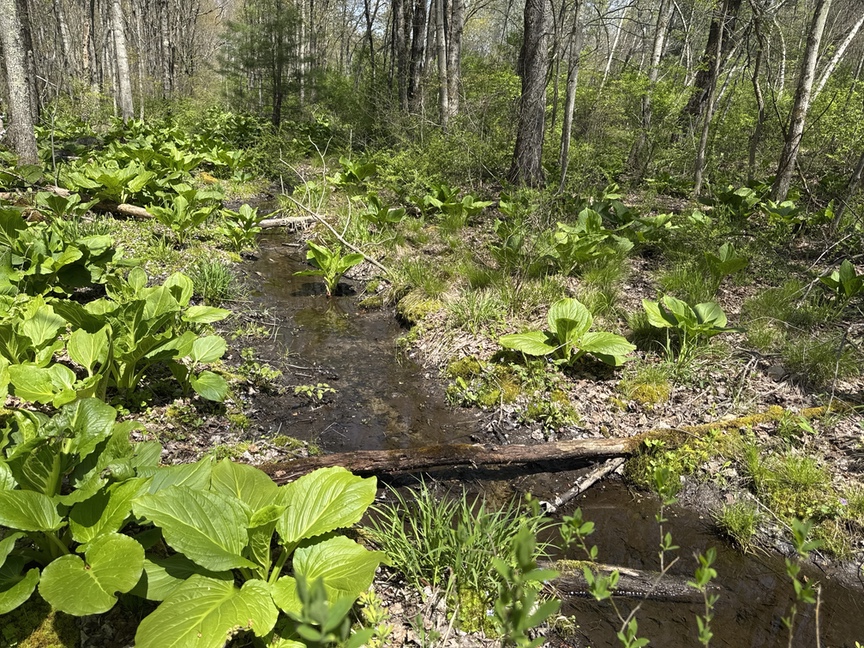
The swamp is a lot easier to navigate, but you’ll still need to pick your way from hillock to hillock and avoid running water as best you can. I was feeling pretty good about things, admiring the skunk cabbages and Jacks as I marched further in.
The ground rises steeply at the back side of the swamp. Really steeply. I was able to switchback up about half of the climb, and then it was hands and knees, crawling up the last 50 feet or so. The elevation gain is only about 400 feet but it happens all of a sudden.
Up top is a complete surprise. Rather than the mixed hardwood canopy I had expected, I was greeted with what had been a pasture a hundred years ago, relatively open space, a few scrub trees, and a few very old pasture oaks. The entire hillside is covered in low-bush blueberry, and they were just starting to think about blooming. They’ll be a nice treat in a few months for hikers who have made it this far.
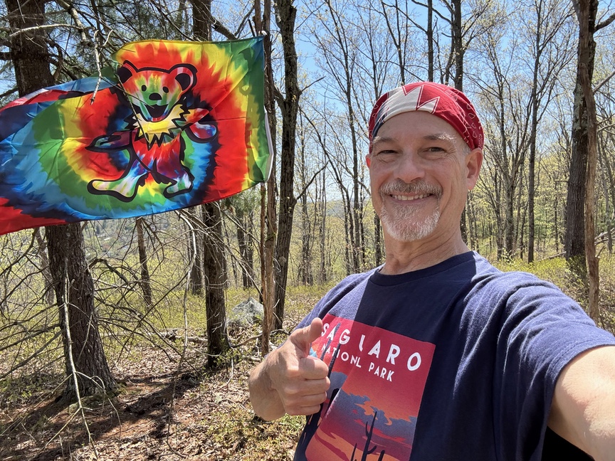
The bands were not in great condition, but I was able to log a dozen QSOs in half an hour or so while I ate lunch. Whenever I am running a ‘rare’ park I always laugh when operators who clearly can’t hear me struggle to make the QSO — calling blind, pausing the amount of time they think I’ll take to send a report — I can usually hear them fine and log ’em with everybody else. I had hiked a mile to get to the top, and so the operation was eligible for the Pack Mule, but I had another ATNO to get to and stopped at a dozen.
Getting out turned out to be the tough part of the trip. The approach to the summit was covered in leaves, and it had rained the day before, so the entire hillside was incredibly slippery. After falling twice I decided that a controlled slide was the right method, and I caromed down the slope from tree to tree and into the swamp.
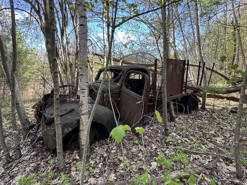
I didn’t go out the same way I came in, and that turned out to be a mistake. I veered a bit west because I saw a hulking shape and wanted to investigate it — it was a rusted-out truck in what looked like the foundations of a barn.
The detour meant that I was on the west side of the parcel, and if you look at the map you’ll see that there’s a small stream feeding the marsh that runs right through there. The briars are intense on this side, too. Stay to the right when you head down.
Past the briars and I was back in the reeds, but I’d had to parallel the stream a bit to the east to be able to get across, and so I was more or less in the center of the marsh. The reed were so thick and tall, well above my head, that twice I had to pull out a compass and make sure I was heading in the right direction.
As a bonus, there is a lot of iron in the rock here, probably limonite at this point, and it has leached out of the granite and quartz to form an iron-rich muck that is at least a foot deep. Nice and cold, too. Standing ankle-deep in this stuff, looking at my compass to figure out where the heck the road was, goes down as one of my low points in my POTA journey. Even though the distance traveled was only one mile in each direction, both the in and the out took about 90 minutes.
But! I made it out, and man, was it sweet to see the car again. I spent some time washing off my wounds, getting those wet shoes and socks off, and then pulled out the map to look for my next stop, Rattlesnake Mountain…