Most people head for Cape Cod at the start of summer for its incredible beaches. You get two different flavors — the Cape curls around like someone flexing their arm around Cape Cod Bay, and the result is a long ocean coastline with rugged beaches on one side and pristine sandy bay beaches on the other. Much of the Cape feels like it was frozen in time back in the 1950s, it has a charm that is quite unique, and once you drive over one of the two bridges connecting the Cape with the mainland it’s like you’ve been transported back in time
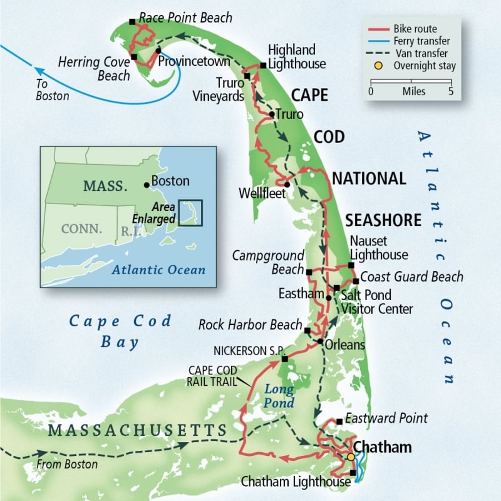
 POTA references on Cape Cod. Nickerson is at the inside of the elbow.
The Cape Cod National Seashore extends for forty miles along the east coast, offering wild, undeveloped areas for exploration among the dunes of the Atlantic. And there’s an extensive bike trail system will get you just about anywhere on the Cape, but be careful, distances can be deceptive out here!
I live not far from the Cape and I’ve spent a lot of time enjoying much of what it offers. My dear, departed Yellow Lab Maggie loved Race Point Beach in Provincetown, and I’d fly her over in our little plane on summer days. We’d sit on the beach and eat Cheetos until sunset, then head back home, the air so calm that t’d feel like we were motionless, suspended over the blackness of the bay.
Biking, too! The Cap Cod Rail Trail covers over 25 miles and a spur will take you into the charming town of Chatham. My wife and I have logged hundreds of miles on those trails, it is still one of our favorite spots to bike. There are several spots directly on the bike path to stop for food and refreshment, including at least two bike shops with supplies and repair facilities. The Rail Trail takes you through quintessential Cape open spaces and towns. It’s worth a side trip down to Chatham, especially during Shark Week!
 Cape Cod bike paths
Many of those bike trips took us right through Nickerson State Park, and we’d often stop there to take break and maybe ride into Brewster for a snack. In all those years, though, I’d never really hiked in Nickerson, just peed there once in a while. That changed this year with three visits for hiking and POTA, one of them a camping expedition.
A spot away from the beach…
Nickerson State Park is really different. It doesn’t have beaches on the Bay or the ocean, but it does have some of the most beautiful beaches I’ve seen in a while. The park encompasses several glacial kettle holes, and they are the main attraction for most people, but there are also eight miles of trails and several campgrounds available. It’s around 2,000 acres in total, and you can spend quite a bit of time on the trails without running into anyone.
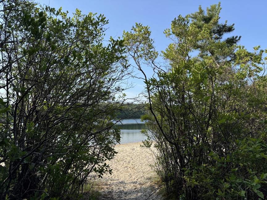
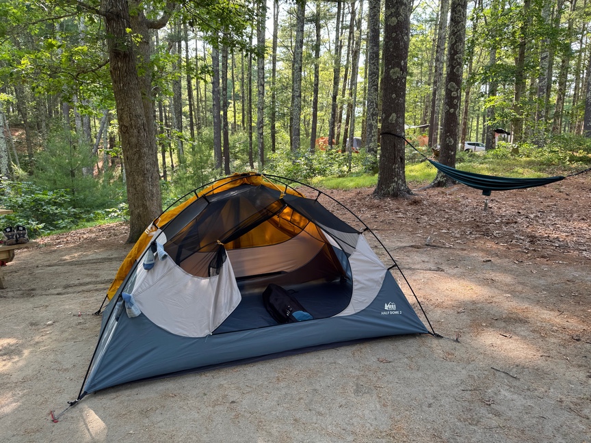
I hiked Nickerson in June and decided to come back a few weeks later to camp for a few days and get in some POTA activating. There are several designated camping areas in the park — I chose one on the banks of Higgin’s Pond in Area 7, pretty much as far away as you can get from anyone.
I didn’t have any trouble reserving a spot toward the end of June only a week in advance. Nickerson takes reservations via Reserve America, and in June wasn’t accepting walk-ins. It was crazy hot and I was looking for a break from the heat for a few days, and so a campsite right on a pond was non-negotiable. The reservation system provides photos taken from each camp site, which made it easy to find jsut the right spot. Or, rather, the runner-up spot, as the really perfect site had been reserved. I still had a nice view of the pond, and a little path that led to the portal in the photo above.
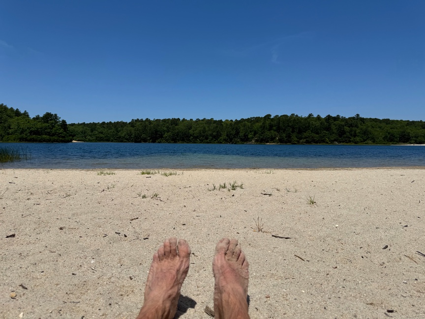
On the other side of the portal was a crystal clear pool of water at exactly the right, refreshing temperature. I spent quite a bit of my stay like this:
I didn’t visit all of the camping areas, but Area 7 was recently renovated and featured a very nice restroom / shower facility that included a dish sink. There’s a camp store nearby and quick access to facilities for RVs.
The campsites and trails intertwine these lovely ponds. Higgin’s is on the small side, with Cliff Pond, maybe a mile away, is much larger, and there you’ll find non-motorized boating. The ponds here are glacial kettle holes, formed when large chunks of ice became lodged in the ground as the glacier melted. Those chunks melted much more slowly than ice at the surface, and as it melted the ground subsided it formed these large, circular depressions
The kettle holes sit below the water table and are fed primarily through aquifers from below that take in water percolating down through sediments that are mainly glacial outwash and gravels. The process purifies the water, and as a result the kettle holes remain beautifully clear.
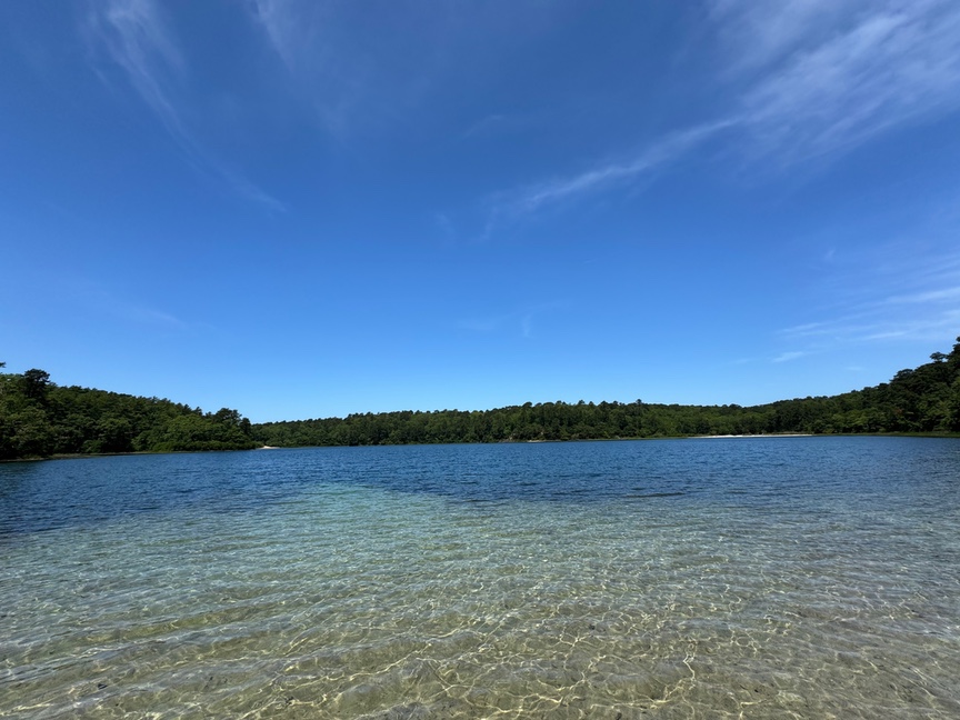 The water is achingly clear
I saw quite a few fisher-peoples out both in boats and along the shore, mainly they were catching small-mouth bass. One fellow said he was hunting pickerel, but I didn’t see him catch any.
A quick trip to the Ice Age
The entire area of New England down to well south of Long Island was under a mile of ice as recent as 13,000 years ago. Archaeological evidence shows a human migration from the south to the north as the glaciers retreated, but is was a slow process — the edge of the glacier was around the location of Long Island around 23,000 years ago, its southernmost extent.
When a glacier “stops”, it isn’t really stopped, but rather it’s that the melting at the front of the glacier balances out the advance from the rear. It is still flowing. When the Laurentide ice sheet sat across the southern coast of New England, it was a conveyor belt for material being ground up and transported from the north. The northern and southern spines of Long Island are made up of this material.
It took about 5,000 years for the edge of the glacier to move from Long Island up to Cape Cod. By 18,000 years ago the edge had cleared the Cape, and it would start to retreat more rapidly as the ice melted. Humans continued to move northward as the ice backed away.
An interesting sidenote: Stellwagen Bank, an underwater bank about five miles off the coast of Cape Cod, is a place where fishing nets have occasionally pulled up mastodon teeth. During the last glaciation, vast amounts of water were locked up as ice for tens of thousands of years, and global sea levels were roughly 400 feet lower than they are today. What is now seafloor would have been dry land — likely a broad coastal plain. It isn’t hard to imagine that human communities gravitated toward water, and that any archaeological sites from this period are now submerged. While there is no direct evidence that humans hunted mastodons off the Cape, we can establish that people and mastodons occupied the same landscape at the same time — and we also know how much humans like a good steak.
Activating
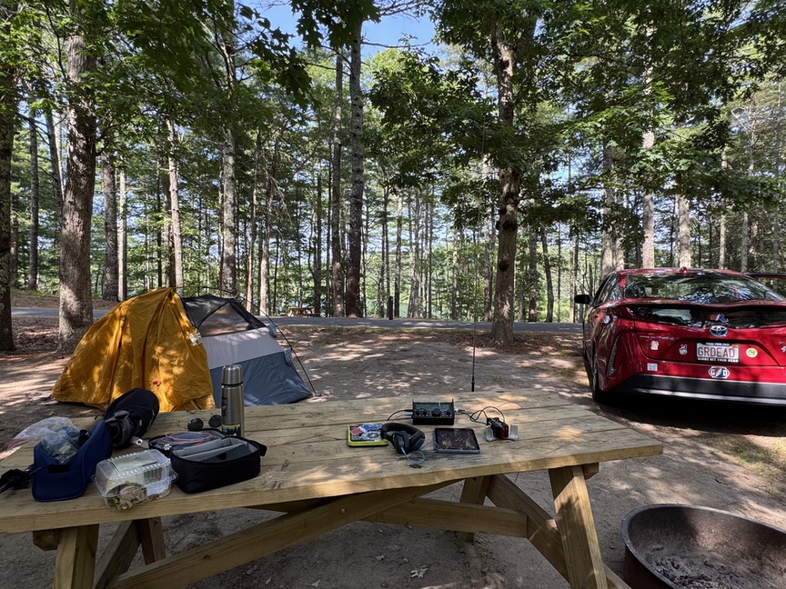
This was a very different activation for me. Typically I’ll hike into the activation site, sometimes several miles, and then hike back out when I’m done. I once joked about hiking nearly five hours to get to a picnic table at the top of Mt. Wilson. Because I was living inside the POTA reference, I just operated from the little table at the campsite.
The first difference was the time of day. I’m usually setting up a radio in the woods around 18Z, noon to 1pm local time. This time I was able to sit and do a quick activation in the evening after a day of hiking.
A second difference: My pack is normally around 32 pounds for a POTA hike, but now I was able to throw a snack and some water in the bag and head out to the trail. I like carrying the weight, it feels good on my back, but I can’t lie and say it wasn’t a nice change not to lug that stuff around.
I had the KX2 along with me and even though there was plenty of room for a wire went with the Gabil GRA-7350T, a nice, compact vertical that’ll get a signal out from 40m to 10m. I love it for its compact size and the simplicity of its loading coil. Tuning is quick, I set the coi roughly by ear, and that’s always close enough for the KX2 to get a good match.
I more often use a 17′ whip, it removes the complexity of the coil and is a champ on 20m. When I activate, my goal is to get a dozen contact as quickly as I can and then pack up and get back on the trail. Every once in a while I’ll linger and just enjoy making contacts, but that’s pretty rare. I’ll usually set up the vertical, find a spot on 20m, and then just call CQ until I’m at 12. On a good day I just cal CQ once, work the pileup for ten minutes, and then I’m packing up.
Hiking
Nickerson offers a few different environments to hike, and one trail can sometimes bring you through several. The major trails ring each of the ponds, and they connect, so you can walk around Cliff Pond and then Flax Pond and then Little Cliff and back. These trails are close to the ponds, so it’s mostly a beach / coastal walk in scrub pine low brush. The interior of the park is a little more upland hardwoods, a surprise when you were just in scrub pine. I found the interior trails were significantly hotter than the beach trails…the ponds are large enough that you get a nice little breeze coming across the water.
Cliff Pond has an honor-system kayak rental business set up on the west side of the pond. They have a lot of kayaks and paddle boards. There are also boat launches along Cliff Pond for those who bring their own equipment. Fishing is popular at both Cliff and Little Cliff Pond, mainly smallmouth bass and the occasional pickerel.
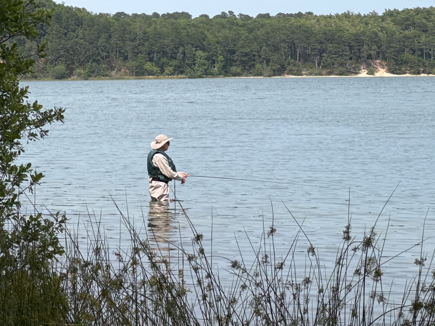 A fisherman along Cliff Pond
The hikes are level for the most part level, and the trails are very well-maintained. Because most of the trails ring the ponds, they are relatively busy, and in the summer there will be quite a few people at the beaches with car access. There are a lot of beaches here and you can absolutely find a quiet spot to settle down. In the three days I was at the park, I ran into only one other person on Higgin’s Pond, and they were just cutting through on their way to Eel Pond.
That Bites…
I have to mention one more thing, which is that Cape Cod is a massive breeding ground for ticks. I’ve pulled ticks off of me every time I’ve been there, and on this POTA camping trip finally ran out of luck and caught a bad case of Babesiosis, a tick-borne bacterial blood infection. It was pretty bad. Be vigilant and use good quality tick repellant when hiking here, it isn’t the time to save money.
That’s not going to keep me away, though! I’ve already started planning next summer’s camping trip.